Datei:Atlantik.gif
Zur Navigation springen
Zur Suche springen
Es ist keine höhere Auflösung vorhanden.
Atlantik.gif (328 × 328 Pixel, Dateigröße: 12 KB, MIME-Typ: image/gif)
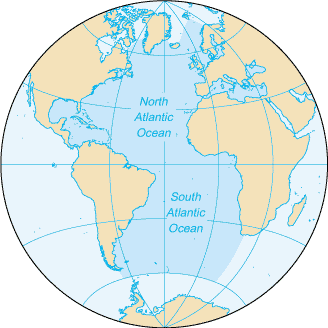
Die Karte stammt aus dem CIA World Factbook (dort als "zh-map.gif").
Lizenz:
The Factbook is in the public domain. Accordingly, it may be copied freely without permission of the Central Intelligence Agency (CIA). The official seal of the CIA, however, may NOT be copied without permission as required by the CIA Act of 1949 (50 U.S.C. section 403m). Misuse of the official seal of the CIA could result in civil and criminal penalties.
Dateiversionen
Klicke auf einen Zeitpunkt, um diese Version zu laden.
| Version vom | Vorschaubild | Maße | Benutzer | Kommentar | |
|---|---|---|---|---|---|
| aktuell | 10:12, 26. Feb. 2006 | | 328 × 328 (12 KB) | Erik (Diskussion | Beiträge) | Die Karte stammt aus dem [http://www.cia.gov/cia/publications/factbook/ CIA World Factbook] (dort als "zh-map.gif"). Lizenz: The Factbook is in the public domain. Accordingly, it may be copied freely without permission of the Central Intelligence Agency |
Du kannst diese Datei nicht überschreiben.
Dateiverwendung
Die folgende Seite verwendet diese Datei: